August 16 (Day 58)

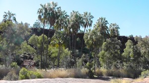
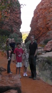
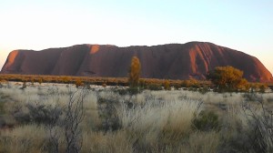
When we had been in Alice Springs for a couple of days, we went west to Uluru. We stayed at Yulara, where you could see the rock from. We spent two nights there. Uluru looked pretty spectacular at sunset. We also visited the Olgars. We did a walk there to the valley of the winds. I could see why it was called the valley of the winds! You could not believe how windy it was there. The next place we visited was kings canyon. The walls there were HUGE!!! I also wanted to tell you that I have jumped over kings canyon. On the walk we did, we passed the part of the canyon that had originally been a creek and we were able to jump over that. We went back to Alice Springs then headed north towards Tennant Creek. Finally after two long days of driving we reached Katherine. I also wanted to tell everybody that is my dog Sandy’s birthday today.

The Red Centre to Katherine

We took 3 days to get to Katherine. We had thought we would do some free camping both nights, but as it turned out, we stayed at Alice Springs for the first night. This is because, as we were driving back along the Lasseter Hwy during the first day, an orange light lit up on the dashboard indicating that the fuel filter was dirty. Michael was worried that there might have been water in the fuel, so he stopped on the side of the road to check it. He also looked up the instruction manual for the car to find out more about the fuel system. He learnt that the indication was just for a dirty fuel filter, not water in the fuel. So he was happy to keep driving, but wanted to stop at Alice Springs for the night, rather than travel further north, so that he could buy a new fuel filter and install  it the next morning (it was Sunday that day, so we were going to have to wait until Monday morning). We stopped at Erldunda for lunch that day and he did some reading on the internet about the issue – he thinks that perhaps the fuel out here is dirtier (perhaps from the red dust) and so fuel filters need changing more often than otherwise specified.

So we ended up going back to the same caravan park we had stayed at previously (we had found it good) and the kids had another play at the playground. 

The next day, Michael bought the new filter and installed it, and then we were off north along the Stuart Hwy. This 2nd day was mainly retracing the 500km or so we had driven a couple of weeks earlier. We came to the Threeways again and continued on for another 60km to a free camping area at a place called Attack Creek. We had a bit of a history lesson, as I had read where this was the site where John McDouall Stuart and his team had been attacked by aboriginals during his 2nd attempt to cross the continent from south to north. The attack was severe enough to thwart that attempt. History tells us that he was successful on his 3rd attempt. Once again, this free camping site was quite crowded. It was also closer to the road than the previous one, and, being the Stuart Hwy, lots of road trains passed by, which were quite loud. We didn’t hear them in the middle of the night though. The kids were still keen for a fire so we did another one here – but had a break from the marshmallows this time.

The third day of driving was another 600km to reach Katherine. We passed through localities called Pamayu, Elliott, Daly Waters and Mataranka. Most of these were no more than a roadhouse, perhaps a general store and a few houses. Mataranka was probably the largest. We stopped here for afternoon tea and a play at the park. It was the site of the ‘Big Termite’ – depicting how much of the landscape of the NT was covered in termite mounds. We had certainly noticed it even more prevalent as we drove further north. The other thing we noticed was how much warmer it was getting as we drove north. It was definitely more shirts and shorts weather by the time we reached Mataranka – in fact it was nudging towards 30degrees. Mataranka is only an hour south of Katherine, so we had texted my sister Liz at that point and she was going to wait for us at her workplace and meet us somewhere in Katherine to guide us out to her place, which was on a property about 18km out of Katherine. We arrived at Katherine just after 5pm and wanted to pick up a few grocery supplies and also go to a dump point and fill up with fuel. We ended up meeting Liz at the Woolworths carpark. From there, she led us back to her place. She lived in a granny flat attached to the back of a shed on a 36acre property belonging to an older couple. The main house was a long way from the shed, so she had a lot of privacy and tranquility to herself. She had only moved in about a month ago but was loving it. We were able to park the van close to her granny flat and use an extension cord to plug in to power. This meant we could keep our fridge running and everything and not have to overtake Liz’s small fridge. We had dinner under the pergola outside her flat – and celebrated with a dessert of apple pie and ice-cream (since we were able to use Liz’s oven – and she had a big deep freeze). It was good catching up with her.

It was Tuesday when we arrived and Liz still had to work the next 3 days. But she was happy for us to chill out at her place. This is just what we needed. So I’ll take a break now from blogging for a few days and just ‘chill’. 

Kings Canyon

We had done some reading on the walks at Kings Canyon. The rim walk is the most spectacular and gives the best impression of the awesomeness of the canyon. It is a 6km loop walk with the first 400m being the hardest with having to walk about 400 steps straight up to get to the top of the rim. We thought that the younger girls should be able to handle it if that was all we did that day and we did it first thing in the morning.

So we got ourselves ready and packed snacks and lunch to take in the backpacks, along with plenty of water. We left the campground just after 9am and drove the 30km to the Kings Canyon carpark. We had a look at the information boards and then started the walk.

It was about 100m to the bottom of the steps. Then climbing the steps. The girls did really well. Bethany kept telling us she has “never ending energy”. So we said we would remind her of that closer to the end of the walk. We saw quite a few other people doing the walk. It is quite popular. At the top of the steps you are rewarded with a great view straight away. Then there was a nice flat section which went past some interesting rock formations. Just after the first km we came to the first cliff edge. We were a bit surprised that there weren’t any guard rails across the cliff edge. There were warning signs but that is all. Along the walk there are many areas where you can potentially go quite close to the cliff edge, but no guard rails. This made Michael feel very uncomfortable – he was continually making sure the kids weren’t going too close to the cliff. Other walkers were going quite a bit closer, wanting good photos. After about 3km, we walked down into the gorge a little way at an area called the ‘Garden of Eden’ – this was a more lush area of the gorge. We went across a wooden bridge onto the other side. Then we started to head back towards the carpark on the other side. The views towards the opposite cliff were amazing. We stopped a few times for drink or food breaks. Eventually we saw the end of the walk in sight. The girls had done very well and not had to be carried for any of the walk – we were very proud of them and celebrated with some lollies in the car (which we had meant to take on the walk but had left in the car). The walk had taken about 3 hrs.

We drove back to the caravan park and had a rest. I actually had a nap and Michael watched a movie on his laptop while supervising the children playing quietly.

We started another fire just before dinner and toasted marshmallows again after dinner.

This was the end of our planned touring of the red centre. Tomorrow we were going to drive the 400km or so back to Alice Springs and then continue heading north towards Katherine, where my sister, Liz, lives. We are looking forward to having a break from sightseeing there.

From Uluru to Kings Canyon

We planned to take the whole day today to get to the Kings Creek Station campsite, as we did not plan to try to see the canyon until the next day (knowing that it was going to take half a day to see it properly). 

So we packed up in the morning and left the Yulara campsite. We drove back in to Uluru to see if the climb was open. It was even windier today so it wasn’t open – a disappointed Sam again, but he did very well to cope with his disappointment. We did another short walk near the base and then said goodbye to Uluru and headed back east along the Lasseter Hwy. We retraced our path for about 150km and then turned north onto the Luritja Road. From the turnoff it was about another 150km to Kings Creek Station (KCS) where we were going to stay. KCS was about 30km south of Watarrka NP (the national park which encompasses the western end of the George Gill Range in which Kings Canyon is located). 

We arrived at KCS mid afternoon and set up. It was very much a bush campground with very basic facilities, but the good thing was there weren’t many people there and also we could have a campfire right next to the caravan. So it was similar to our free camping experience. It was good to have a bit of the afternoon to relax before starting dinner and night-time routine. After dinner we roasted marshmallows on the campfire again.

A Day at Uluru and Kata Tjuta

Uluru is one of those iconic Australian landmarks that most children grow up knowing about and having seen pictures of. And it’s one of those places I imagine many Australians would like to see for themselves at some point in their lives. This has been the case for me. Having seen many pictures of it, it was amazing to think that I was there now, actually seeing it for myself.

Part of the whole learning experience was seeing how the whole ‘visiting Uluru’ thing is managed now. I really wasn’t sure what to expect, until a couple of days before coming here when I did a bit more specific reading on it – even then it was all still a bit unknown.

For example, seeing Uluru at sunrise is a whole exercise in logistics. There is a specific viewing area for sunrise and a different one for sunset. And apparently there has been a bit of contention about where these have been chosen to be located. Anyway, so you find out the time for sunrise on the day you want to see it and you have to allow half an hour drive from the campground area to drive into the NP and to the sunrise viewing area. So I got up at 6am and nudged Lauren and Sam to see if they wanted to come – they both did. We had a quick bite to eat and a cuppa and left the campground at 6.30am. The entrance to the NP was 5 mins along the road and here we had to buy passes to the NP ($25 per adult, children 16 and under were free – yay). We drove past one side of Uluru and marvelled at the amazing structure that it is. The sunrise viewing area was around the other side. We got there by 7am and it was already packed with people. Sunrise was 7.25 am today. We joined the throng and took some photos. Then about 7.30 we headed bak to the caravan where Michael, Hannah and Beth were finishing breakfast.

We got ourselves ready for the day and drove back in towards Uluru, this time taking the road towards the Mala walk and where the Uluru climb starts. We had looked at the different options for doing walks around the rock. Many people do the walk around the whole base, but being 7.5km, it was not something we thought we would try to do with the young girls. It is obvious that the rangers discourage the climbing of Uluru because there is absolutely no reference to where the climbing area of the rock is, either on the official map or the road signs in the park. We had to guess where it was. As far as the whole climbing thing was concerned, that was an education in itself for our family. Sam absolutely loves rock climbing and so was keen to do the climb. We had been talking to him (and all the kids) about the issues around it and why the aboriginal people and rangers discourage it. He took all this on board and read up on it on some websites. In the end he still wanted to do the climb, but with a respectful attitude about it. So Michael was prepared to do the climb with Sam and Lauren. However, as it turned out, the climb was closed due to strong winds at the summit. Sam was disappointed, however hopeful that the climb would open either that afternoon or the next day.

Our alternative plan was to do the Mala walk (which I had planned to do with the girls anyway). This was a short walk to a gorge area at the base of the rock. We found out that there is a free ranger-guided tour on the Mala walk at 10am each day. It was 9.15 at the time. So we decided we would go back to the cultural centre for a little while, until the tour start time. We did this – it was a fairly quick look. Then we were back at the start of the Mala walk. We met our ranger guide -Tim. He indicated it would be a 2 hr tour with lots of information about the cultural aspects of Uluru, as well as the geological aspects. We decided we would start with the group, and see how the kids were holding out as to how long we stayed with it. It turned out we stayed for the whole 2 hrs and learnt quite a lot of interesting information. Lauren and Sam listened in to all of it, and Hannah and Beth listened to some and played in the dirt quietly for a lot of it – this was OK. We learnt about how the more lush vegetation was close in to the base of the rock because when it rained the rock had sections of it which became like waterfalls and directed water to certain areas around the base. The aboriginals would come into the area and gather food etc for a period and then move on. They didn’t tend to live permanently at the rock. We learnt some more about the bush tucker and how they made their weapons and eating implements from the bark of trees. We saw some aboriginal art sites and our guide described some of the background to aboriginal art and how it usually tells a story. He did this by drawing with a stick in the dirt and it was very interesting the way he described the whole thing. He had all the kids captivated. For the next few days Hannah and Bethany were always drawing pictures and stories in the dirt. Next we learnt about some of the geology of the rock – that it is actually feldspar – a metaphorphosised type of sandstone. Pure feldspar is actually a greyish colour, but the rock looks red because the red dust from the surrounding plains blows onto it and it now has a thick layer of this red (rust) dirt on it. Rather than being smooth, the surface of the rock is actually like shingles on a roof, facing upwards. This is due to the effect of the water running down the rock and causing ‘blisters’ that lift off, just like the blistering that occurs on a rusting car. Our guide described it like a cheese grater. And he said it does damage like a cheese grater when people fall  doing the climb and slide down. We learnt a little bit about some of the mammals in the area too. We finished the tour at the waterhole of Mala gorge. We then all walked back to the car.

We had decided to also drive out to Kata Tjuta (the Olgas) today and do a walk out there. Kata Tjuta is about 30-40km further west of Uluru. It is a series of domes, also composed of Feldspar. They have similar geology to Uluru, but formed into smaller domes rather than one big dome. They also have the cheese grater effect on their surface. It was a half hour drive to Kata Tjuta, although it took a bit longer because we stopped at the viewing area which was on top of some dunes. The walk we had wanted to do was called the Valley of the Winds. The first 1km was a return walk to a lookout area, and from there it was a loop walk within the domes for another ?km. We would have liked to do the whole walk, but we knew Hannah and Bethany would not be up to it. So we just walked to the first lookout area. It was an amazing feature in itself. It was about 2.30 by now and, since we were going to have an early dinner to go and see Uluru at sunset, we decided to head back to the van. 

We got back around 3.30 and so the kids had some down time. Lauren usually likes to read, watch a movie or check emails etc. Sam usually likes to keep doing active things – ride his bike, kick a ball, go to the playground or find a tree to climb. Hannah and Beth love to just be together playing a ‘let’s pretend’ game – there is always a story involved. Sometimes it is at the playground or pool or sometimes just around the van somewhere. If they are getting tired then being together is not always the best option – sometimes we have to separate them and give them different activities to do, sometimes at different ends of the caravan. This time Michael took them to the pool  for a while and I got some things ready for dinner. We were having a BBQ for dinner and trying some kangaroo meat with the sausages.

We were having dinner by just after 5pm, planning to hop in the car at 5.30 to drive to the sunset viewing area. I was feeling rather tired by now after the long day and decided I might opt out of going and just see the photos the others took. So I stayed back and did the washing up and then some quiet time.

Then once the others got back, they showed me the photos and then it was time for showers and off to bed. It had been a long day but a good day.

Day driving to Uluru

It was going to be about a 4 and a half hour drive from Alice Springs to Uluru. We didn’t plan on doing any sightseeing today, so we felt that we didn’t have to rush to get away. So we took our time packing up in the morning and made a trip to get some groceries, swap a gas bottle, fill up with petrol etc. it was well and truly 11.30 before we left AS.

It was a fairly uneventful drive, passing through the township of Stuart’s Well and then reaching Erldunda which is where you turn off the Stuart Hwy and head west along the Lasseter Hwy for 300km to get to Yulara (the township just outside the National Park which encompasses Uluru and Kata Tjuta). The kids hadn’t done any schoolwork for a few days, so it was hard to get them going again with that, but eventually it got done. We stopped a couple of times for toilet breaks and morning or afternoon tea. The only real point of interest on the drive out to Uluru was Mt Connor about half an hour short of Yulara. We had read about this feature and how uninformed people sometimes think this is Uluru itself when they first see it. I could understand why – from a distance the shape is not dissimilar.

We finally arrived at Yulara at about 5.30 and checked in to the campground at Ayers Rock Resort, where we had rung ahead earlier that day. Yulara is basically made up of the resort, which has a few styles of accomodation from hotel, cabins to caravans and camping. There is also some shops and restaurants etc. The campground is quite big. It would need to be as it is the only one close to Uluru (and obviously there is no camping inside the NP). Michael has actually been to Uluru before – nearly 30yrs ago, with his mum and his brother Richard. At that time there was no Yulara. Instead there was a motel and camping area almost at the base of the rock – how things have changed.

We had thought of trying to see Uluru at sunset tonight, but it was another half hour drive to the ‘viewing area’ for sunset. Considering we still needed to have dinner and Hannah and Beth were tired, we decided against that – we would do it tomorrow night. While I cooked dinner, Michael took the kids to the lookout area at the campground – could see Uluru from here, although a lot further away than from the viewing area inside the NP. They were excited to be seeing something so famous.

We made plans for the next day. I thought I would get up early to go to the sunrise viewing and see who else out of Lauren and Sam wanted to come. When we talked about it at dinner, Hannah and Beth thought it sounded too tiring to get up at 6am (they are both getting very tired still – we are holding out until a few more days when we get to my sister’s place at Katherine when we will really rest for a week).

So I set my alarm and went to bed.

2 Days at the West McDonnell Ranges

One of the places we wanted to visit here was definitely 4WD only (Palm Valley) and we weren’t sure about some of the others, so we decided to do this area as day trips from AS, rather than take the caravan.

The first day, we drove along Larapinta Drive all the way to Hermannsburg (an early Lutheran mission homestead) and stopped here for a short while to look at the old buildings and take a few photos. We then turned off the main road onto the 4WD track towards Palm Valley. It was about 22km into Palm Valley, but at a slow speed so it took about 40 mins. We got there about 11.30. It was not quite what I had expected. I had thought there would be more palms and a more lush picnic area. Although it was unusual having the palms there, the main landscape was still quite arid desert and there was just a small shelter built with some seats within. There was a 2km loop walk which went along the base of the valley and then up on the cliffs above. We did the walk –  it took about an hour, and we needed regular drinks as it was hot in the middle of the day. We then went back to the car and had lunch and started the drive back out to the main road. We saw a dingo beside the road as we drove out.

We then drove back along Larapinta Drive towards AS as we were planning to go to Standley Chasm and Simpson’s Gap which were the 2 closest ‘features’ to AS. We arrived at Standley Chasm carpark at about 3.00 and had some morning tea before we did the 600m walk in to the chasm. We hadn’t realised that we had to pay to go to the chasm – it was now managed by local aboriginals and they had installed an entrance fee. It was $35 for our family which seemed very steep. Since we were here now, we paid it, but had we known beforehand that it was the only one of the gorges/waterholes/rock features that had an entrance fee, we would have skipped it. Anyway, we walked to the chasm and enjoyed seeing it. There was no water in it at this time of the year.

We decided then it was getting a bit late to do Simpson’s Gap, so we would add that to what we planned to see the next day. We decided to get the lunches and morning tea ready as much as we could that night, so we could get away earlier the next morning.

The second day, we got away about 8.30am. We drove back along Larapinta Drive and stopped at Simpson’s Gap first. It was only a short way out of town, so we were there by just after 9am. It was only a short walk along a paved track to the gap, and it was quite cool because the sun hadn’t reached into the gap yet. There was water right in the gap, but not in the river bed beside the track. It was lovely just to stand and look at the reflections of the tall red cliffs in the water and listen to the bird life. We probably stayed for about 10 mins and then walked back to the car and headed off for the next stop. We drove about 30km further along Larapinta Drive and turned off onto Namatjira Drive which headed further north than we had gone yesterday. Our first stop along here was Ellery Creek Waterhole. Once again a short walk from the car park. This place was probably my favourite out of all of them. It was beautiful. We sat down here in the shade and had some morning tea and the kids played around on the rocks and tree branches for a while. We were the only ones there for the whole half an hour we sat there and it was very relaxing. Then it was time to move on – next was Ormiston Gorge, another 30km further along. This was a longer walk in and it was getting hotter by now – it was around 12noon. The sun was high overhead so there was less shade now. We walked a little way along the gorge which had a smallish amount of water in it. We were there for about half an hour also, but the kids were getting more tired on the walk back. We sat under one of the shade structures at the car park and had lunch. We decided the kids might want to have a swim at the next ‘spot’, which was Glen Helen Gorge. So we drove the 5min drive to that spot and loaded up with swimmers and towels to walk down to the water at the  gorge. This one, I thought was one of the less pretty ones, but the 2 younger girls and Sam were still keen to swim. So Michael, Lauren and I sat in the little bit of shade we could find and watched as the other 3 paddled in the quite cold water for a while. Eventually it was time to walk back to the car – everyone was feeling a bit drained from the heat. There was accommodation and a shop at Glen Helen, so we all got a paddle pop, which perked us up a bit. We decided not to do the last gorge we had thought we might do – Redbank Gorge. I’m sure it would have been beautiful but we had had enough sight-seeing for the day, and we wouldn’t have enjoyed it as much with everyone being tired. So we then headed back towards AS. There was one place we had not stopped at on our way out which we decided to call in on quickly on our way back. That was the Ochre Pits. It was only a few hundred metres in from the main road. It was the area where the local aborigines used to go to gather their ochre for their traditional body paints and so on. Sam was interested in seeing it so we stopped in their briefly. Then it was about an hour’s drive home from there. We got back about 4pm so the kids were able to have a bit of a play at the playground before an early dinner and bed.

First 3 Days at Alice Springs

We had 3 days of just doing things locally around Alice Springs, and also just trying to catch up on some rest and down time. It’s been just over 6 weeks now that we’ve been travelling and everyone is starting to show signs of weariness. We seem to need to have a lot more down time each day than we did at the start. So we’re taking longer to see things at each place now.

Our first day at Alice we saw the Overland Telegraph Station, the Royal Flying Doctor Service Visitors Centre and went grocery shopping (not everyone did all of them).

– The Overland Telegraph Station Historical Reserve was very interesting. It was a part of Australia’s history which I hadn’t known about previously, and was one of the main factors influencing the opening up of the centre of Australia to European settlement. In the first half of the 1800s, the only means of communication from England and Europe was via letters on ships – taking at least 6 weeks to reach Australia. In 1838, Samuel Morse invented Morse Code and this allowed for messages to be sent over telegraph wires from one country to another in a matter of minutes. This was occurring in England and Europe for a decade or so before it came to Australia. First telegraph wires had to be laid under the sea. This was completed in 1872 with the messages from overseas coming in to Darwin. But then how to get the messages from Darwin to the more inhabited parts of Australia? Adelaide was keen for the telegraph line to come to them, but so was Queensland. Adelaide won out as the governor of SA  pledged to pay for it themselves and to have it completed in 2 years. It was completed in 19months which was a pretty impressive achievement.  Several repeater stations were located along the route, which needed to be manned. Alice Springs had one of them. The station was built near the site of the ‘spring’ which AS was named after, on the Todd River. The historical area that we walked around had the original postal and telegraph office, complete with a working morse code machine to try out sending messages to each other. There were all the updated machines and accessories displayed also. We could walk through the original house of the station master, the barracks for other workers, the blacksmith workshop, the ‘garage’ for the buggies, the horse stables and yards and the camel yards. There was information about the different station masters and their families. It was indicated that one of the families – the Bradshaw family – had a book written about their time there – I found the book that afternoon at the local shops and bought it. After walking around the site, we went down to the Todd River, which was just a dry river bed at this time of the year. However we had read about the water being just a short way under the sand, so the kids decided to find out just how far down it was – they dug down about 20cm and struck water. The girls had a bit of a play there for 20mins or so while Sam went climbing on the rocks on the other side of the river bed.

– The RFDS visitor centre was somewhere Michael wanted to visit. I said I would do grocery shopping instead. Sam decided to go with Michael to the RFDS. Hannah and Beth really needed some down time – they were getting a bit over the tours of different places. Lauren said she would be happy to stay at the van with them while they watched a movie. It was helpful that we could do this. 

– Anzac Hill was the name of the tallest hill within AS and it had a lookout at the top. We had read that dawn or dusk were the best times to go up there and see the view of the McDonnell Ranges all around (due to the colours at that time. So we did this the first evening – we went up about 5.45 and watched the sunset over the West McDonnell Ranges. It was lovely.

Our 2nd day we went to the Alice Springs Desert Park from about 9am-2pm, and then we had a rest for the remainder of the day.

– AS Desert Park is a few acres of land just outside AS and tucked in under the ranges. It is an educational park on all things to do with the desert and the red centre and it is very well done. We had read to get there earlyish as there were a few talks and shows before midday. We arrived just after 9am. At 10am there was a free flight bird show where the birds had been trained to fly in to the open amphitheater on cue for the ranger to talk about them. The birds often flew right above our heads. There were eagles, kites, tawny frogmouths and barn owls among others. It was a fabulous show. We also sat in on a talk about aboriginal culture and their use of bush medicine and bush tucker. Lauren especially found it fascinating all the plants in the bush that could be used for tucker – she loves the bush and is now keen to find out more about the local bush plants around where we live. There were 3 sections of the park showcasing 3 different landscape types in the dessert – the woodland habitat, the desert rivers and the sand country. We each had our own audio guide handset and would press a number on the handset when we came to that area and it would tell about something about that habitat/plant/animal. This was great for Hannah and Bethany especially as it gave them a sense of ownership of finding out about things – much more than if we’d just tried to tell them things. There was also a nocturnal house in which we were able to see lots of the desert animals that come out in the cool of the night – like bandicoots, bilbys, desert frogs, etc. many of these animals are endangered. The other reason we are glad we went early is because by 11.30, it was getting quite hot. We had to have lots of drinks of water. By 1.30pm, we were ready to go back to the caravan for a rest. 

– the kids had a swim in the rather cold swimming pool at the caravan park and a play on the playground.

– Michael had been planning to do some flying at Alice Springs and had arranged the previous day to do a check flight with an instructor at 4pm today. He couldn’t take any of the children on this check flight, so he went and did that on his own while the kids and I had some down time at the caravan.

Day 3 was scenic tours over the West McDonnell Ranges care of Michael Branch Scenic Flights. After ‘passing’ his check flight the previous day, he now wanted to take the family up for a flight over the West McDonnell ranges. Initially he thought he could take all 4 children with him because Hannah and Beth’s combined weights are under the usual weight limit for 1 adult. However he then realised the aero club rules wouldn’t allow this. So he did 2 flights – first with Hannah, Beth and I (Lauren and Sam waiting at the car down below) and then with Lauren and Sam. Each flight was about 50mins and we went over some amazing scenery. It was great seeing the ranges from up above. The kids all really enjoyed it, although I think Sam’s eyes were shining the most afterwards – he thoroughly enjoys the flying with Dad.

We then had another afternoon of down time, and Bethany actually had a nap (which she rarely does these days) – she really needed it – Mum had one too:)

We planned for the following 2 days to be day trips out into the West McDonnell Ranges, so they would be a bit more full.
Thursday, 9 August

I’m Lauren reporting live from Uluru, home of the world largest rock and largest cheese grater.

So we spent yesterday driving to Uluru and now here we are, visiting Ayre’s Rock and The Olgas.  We started the day with Sam, Mum and I getting up at 6:30 to see the sun rise over Ayre’s rock (Dad and the girls were still asleep). Then we all had breakfast and headed out to the National Park.

We would have climbed to the top of Ayre’s Rock but it was closed because of the windy weather. Instead we did a guided walk to a waterhole at the base of the rock called Mala. The cheese grater thing was something we learned from the tour guide. The surface of the rock is like a cheese grater in that it is made of rusted shingles (like house roof shingles) of sandstone which point up rather than down as they peel of the rock. The result of someone sliding down Uluru is similar to the result of an apple on a cheese grater. Not pretty.

We drove to the Olgas and did the walk to the Valley of the Winds, where the wind was so loud you could hardly hear people speak! After that it was already one so we came back to the van for an early dinner of barbequed sausages and kangaroo and then drove back out to the park to watch the sunset and turn the rock from bright orange, to deep red, to dark purple.

Tonight has been an early night for everyone and a hope that tomorrow will be more promising in regards to the climb (Sam was really disappointed that it was closed).

Interim

We have had 3 days here at Alice Springs now, doing some things locally, which I will blog about soon.
Tomorrow and the next day we are planning 2 days of ‘day trips’ out into the West McDonnell Ranges where there are some beautiful gorges, chasms and waterholes to see. We’ll come back to our caravan at Alice Springs each night. Then we will head down to Uluru and Kings Canyon – taking about 3 or 4 days to do that. Then we’ll be heading back north towards Katherine to stay with my sister Liz for a few days. Will blog when I can, but some days are so busy I don’t get time.
Love to all, Andrea